ShipIntel Essentials brings high-quality maritime data and advanced machine learning models into one intuitive solution, helping teams broaden their market insight, improve stakeholder follow-up, and unlock new business opportunities.


Tap into high-quality, maritime data and advanced machine learning models to enhance your market insight and uncover new business opportunities.
Maritime Optima collects raw AIS data from satellites, terrestrial and dynamic AIS sources. We clean, unify, and process the data in-house to provide high-quality AIS data for all types of vessels with global coverage.
ShipIntel Essentials delivers reliable, high-quality in-house processed AIS data, enriched with publicly available maritime data so you can do analysis and expand your insight.

Key features:
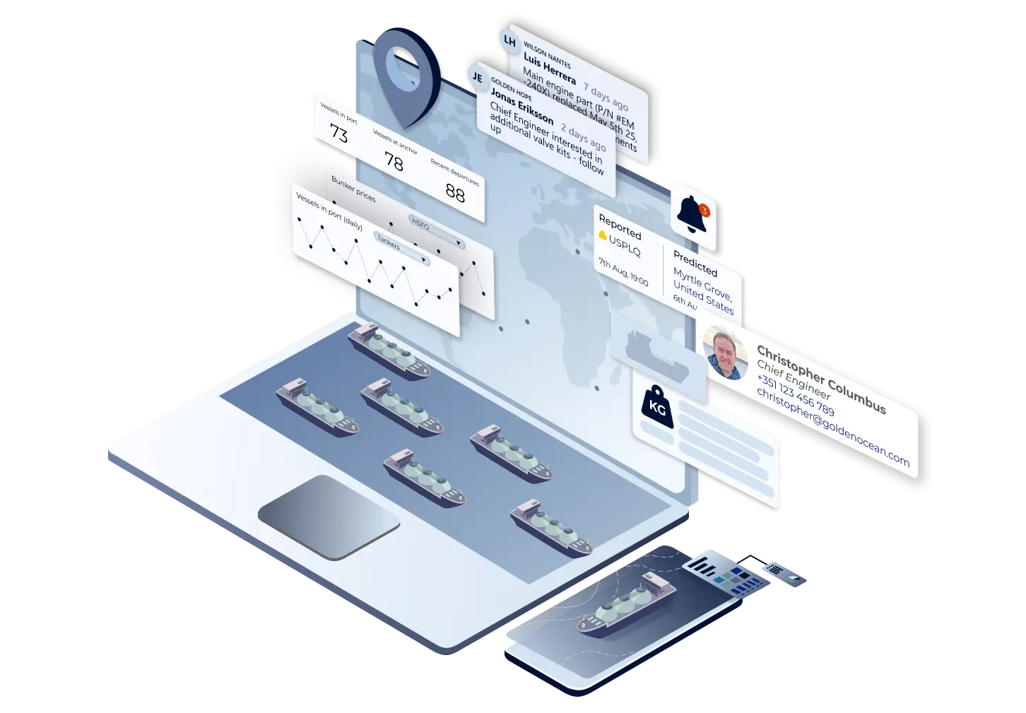
Find vessels historical trading patters, which ports they have visited, which cargoes they were carrying, how much time they spent in ports etc.
Calculate cost savings with the sea route calculator to evaluate investments in dual fuel, scrubbers etc. on new buildings and retrofitted vessels.
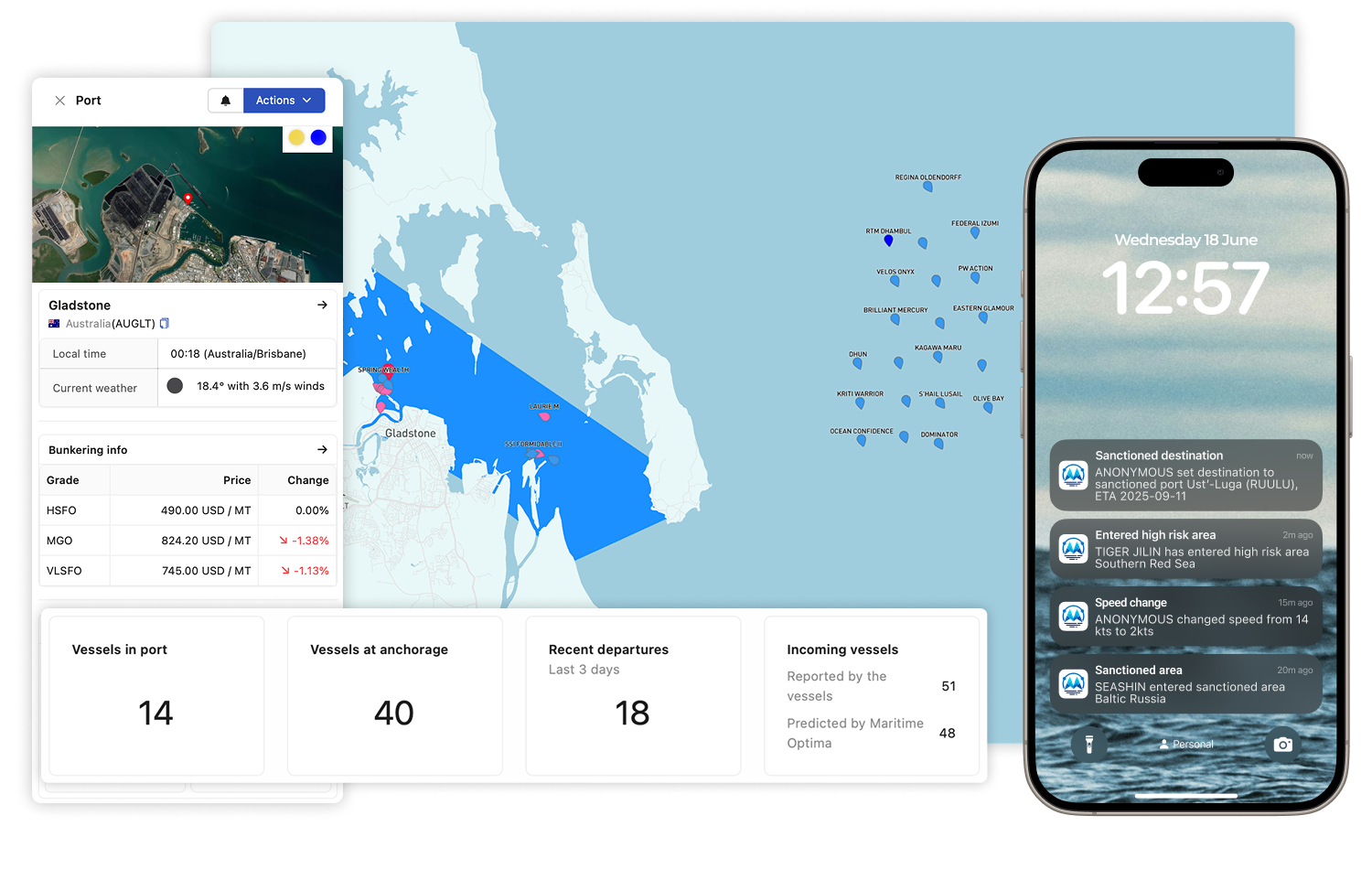
Study the port traffic in any port, find new trading patterns and needs for specific vessels.
Make vessel lists and follow specific types of vessels' trading pattern, find which sea routes they are following, changes in speed etc.
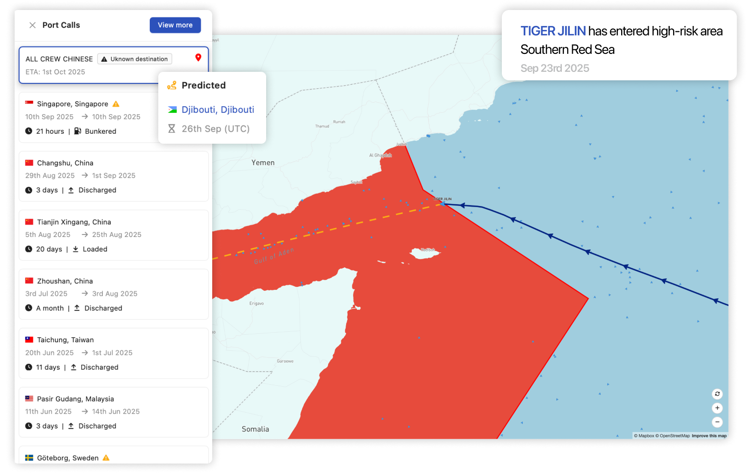
Gain real-time insights into any vessels live operations updated every minute.
ShipIntel Essentials equips your team with the tools and data needed to turn real-time insight into action, so you can reduce risk.
ShipIntel Essentials applies machine learning and AI to the maritime data, including several destination prediction models that forecast each vessel’s next intended port, particularly useful when the vessels don’t want to share their destination.
Key features:
Live processed AIS data updated every minute in a map with the track showing last port, current position and next port.
Create vessels lists for each of your clients' fleets and follow the vessels' live movements.
View live AIS speed and the average service speed for each leg. Get notifications when a vessel’s speed changes.
Receive notifications when:
Break down the data silos. Unlock real insight.
AI thrives on connected data. ShipIntel unifies maritime data and essential tools in one seamless, collaborative platform breaking down AI barriers for context-rich analysis and smarter decisions across your team.
AI alone doesn’t create breakthroughs, but people do
ShipIntel Essentials is made for team collaboration and internal discussions. Collaborate to challenge assumptions, uncover blind spots, and gain balanced, high-value insights.

Key features:
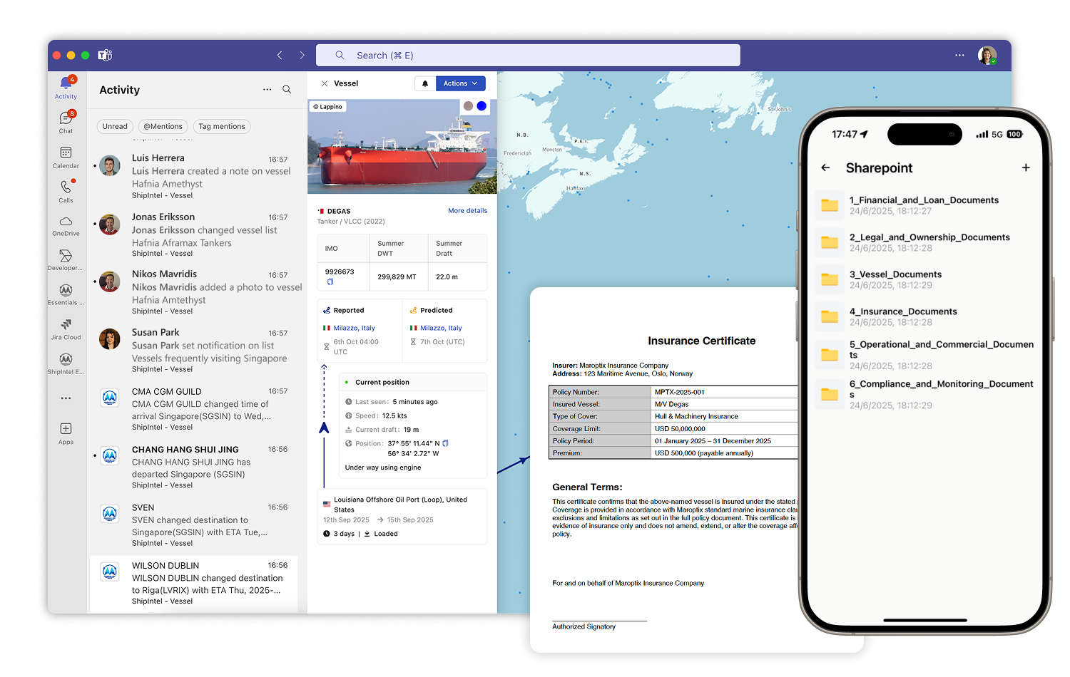
Integrate your ShipIntel Essentials subscription in your Microsoft Entra.
Configure folders or documents to specific vessels to access the information you need when you need it.
Add and share notes attached to vessels and ports in ShipIntel integrated in Microsoft Teams.
Receive notifications on vessels performance or team progress in Microsoft Teams or by email.
Build a team contact book and attach vessel and ports to your client’s and contacts.
Attach notes, documents and folders to vessels and ports.
ShipIntel is on mobile and web, which makes it easy to collaborate on-the-go.
Explore ShipIntel through a live personalized demo where you ask the questions and we show you how to find the answers by using ShipIntel Essentials.


We decided to change over to ShipIntel because it is a great and user-friendly ship tracking system with so much more. With over 50 vessels in our ship project finance portfolio, we need ship details, alerts, port info, traffic statuses and trends all the time. ShipIntel is a tool that easily gives us such information and connects our team.

ShipIntel is our go-to solution for portfolio monitoring. ShipIntel is a reliable software built on high-quality data, followed by excellent customer and user service. Exactly what we need to gain real-time insight to empower our team's strategic decision-making.

Having used several competing AIS providers, we were confident in our decision to add ShipIntel Essentials to our toolbox. We are impressed with its sleek, responsive, and easy-to-use interface and we're excited to leverage its full potential in our day-to-day operations. Maritime Optima has been very attentive, listening to our needs and implementing functions we have requested.

We started using ShipIntel because we needed an AIS software and a sea route calculator. We added more features because we gained access to high-quality AIS data, smart AI searches, and a very user-friendly software at an affordable price. There are too many stand alone softwares, and we have started looking for a kind of all in one software that gives us what we need at an affordable price.
We chose ShipIntel because it is an innovative solution, easy to use, and comes with a very competitive price. We continued using ShipIntel because the Maritime Optima team continuously develop and maintain the software. We also think it is an advantage that maritime software is developed by people that have been working in the industry. So the easy to use, relevancy, high AIS quality and price makes ShipIntel a unique maritime software box.

We believe ShipIntel stands out on key points such as coverage, search/filters/lists, and user interface. The highly skilled IT team is supplemented with experienced shipping people, so we are confident that ShipIntel will continue developing to our benefit.

